Weather Alert in North Carolina
Flood Advisory issued July 9 at 9:08PM EDT until July 10 at 12:00AM EDT by NWS Greenville-Spartanburg SC
AREAS AFFECTED: Lincoln, NC
DESCRIPTION: * WHAT...Nuisance flooding caused by excessive rainfall is expected. * WHERE...Eastern Lincoln County, North Carolina * WHEN...Until midnight EDT tonight. * IMPACTS...Nuisance to Minor flooding of low-lying areas adjacent to streams and other poor-drainage areas, including farmland, parks, greenways, boat-access areas, golf courses, underpasses, and parking lots. Isolated, shallow flows over roadways is possible. A few flood-prone, low-water crossings may become impassible. A small culvert washout or two is possible. * ADDITIONAL DETAILS... - At 859 PM EDT, Doppler radar and automated rain gauges indicated heavy rain is ongoing due to multiple slow-moving thunderstorm cells currently shifting slowly to the south and east, departing Lincoln County. Between 2 and 3 inches of rain has fallen over the past 75-90 minutes. These cells were initially training from west to east over the same areas, prompting concerns for excessive runoff capable of producing areas of nuisance to Minor flooding. Areas of greatest concern include near Pumpkin Center and Ore Bank Branch near King Wilkinson Rd and Ashbury Church Rd and Reed and Leeper creeks near Furnace Rd and NC 73. - Heavy rain is slowly departing the area to the east; however, another inch of rainfall is possible across the southern and eastern portions of the Advisory area, primarily from Iron Station to Lowesville. This may be enough rain to cause isolated areas of nuisance flooding to develop near the Gaston County line. - Some locations that may experience nuisance flooding include... Westport, Denver, Iron Station, and Lowesville. - http://www.weather.gov/safety/flood
INSTRUCTION: Be especially cautious at night when it is harder to recognize the dangers of flooding. Be aware of your surroundings and do not drive on flooded roads.
Want more detail? Get the Complete 7 Day and Night Detailed Forecast!
Current U.S. National Radar--Current
The Current National Weather Radar is shown below with a UTC Time (subtract 5 hours from UTC to get Eastern Time).

National Weather Forecast--Current
The Current National Weather Forecast and National Weather Map are shown below.

National Weather Forecast for Tomorrow
Tomorrow National Weather Forecast and Tomorrow National Weather Map are show below.

North America Water Vapor (Moisture)
This map shows recent moisture content over North America. Bright and colored areas show high moisture (ie, clouds); brown indicates very little moisture present; black indicates no moisture.

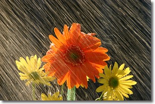
Weather Topic: What is Rain?
Home - Education - Precipitation - Rain
 Next Topic: Shelf Clouds
Precipitation in the form of water droplets is called rain.
Rain generally has a tendency to fall with less intensity over a greater period
of time, and when rainfall is more severe it is usually less sustained.
Rain is the most common form of precipitation and happens with greater frequency
depending on the season and regional influences. Cities have been shown to have
an observable effect on rainfall, due to an effect called the urban heat island.
Compared to upwind, monthly rainfall between twenty and forty miles downwind of
cities is 30% greater.
Next Topic: Shelf Clouds
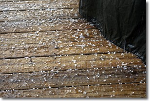
Weather Topic: What is Sleet?
Home - Education - Precipitation - Sleet
 Next Topic: Snow
Sleet is a form of precipitation in which small ice pellets are the primary
components. These ice pellets are smaller and more translucent than hailstones,
and harder than graupel. Sleet is caused by specific atmospheric conditions and
therefore typically doesn't last for extended periods of time.
The condition which leads to sleet formation requires a warmer body of air to be
wedged in between two sub-freezing bodies of air. When snow falls through a warmer
layer of air it melts, and as it falls through the next sub-freezing body of air
it freezes again, forming ice pellets known as sleet. In some cases, water
droplets don't have time to freeze before reaching the surface and the result is
freezing rain.
Next Topic: Snow
Current conditions powered by WeatherAPI.com


