Weather Alert in Alaska
Special Weather Statement issued February 25 at 5:35PM AKST by NWS Juneau AK
AREAS AFFECTED: Municipality of Skagway; Haines Borough and Klukwan; Glacier Bay; Eastern Chichagof Island; Cape Fairweather to Lisianski Strait; City and Borough of Sitka; Admiralty Island; City and Borough of Juneau; Petersburg Borough; Western Kupreanof and Kuiu Island; City and Borough of Wrangell
DESCRIPTION: After the currently ongoing snow showers depart the area, there is increasing potential for more significant accumulating snow to impact the area starting Saturday and going through the start of next work-week. Currently, deep layer of cold air looks to become entrenched over the Inner Channels while appreciable moisture is expected to move onshore from the Gulf of Alaska starting this weekend, giving an overrunning event. The highest confidence for snowfall looks to be around the central Panhandle from Wrangell and Petersburg up to the Icy Strait Corridor, including Juneau. There is some disagreement on the exact location of the heaviest snowfall, which could shift what communities see the greatest accumulations. Part of this will depend on where the cold air sets up across the Inner Channels. Places that stay south of the colder air will see more rain than snow for precip accumulations. Stay tuned for the latest forecast updates at weather.gov/juneau
INSTRUCTION: N/A
Want more detail? Get the Complete 7 Day and Night Detailed Forecast!
Current U.S. National Radar--Current
The Current National Weather Radar is shown below with a UTC Time (subtract 5 hours from UTC to get Eastern Time).

National Weather Forecast--Current
The Current National Weather Forecast and National Weather Map are shown below.

National Weather Forecast for Tomorrow
Tomorrow National Weather Forecast and Tomorrow National Weather Map are show below.

North America Water Vapor (Moisture)
This map shows recent moisture content over North America. Bright and colored areas show high moisture (ie, clouds); brown indicates very little moisture present; black indicates no moisture.

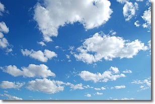
Weather Topic: What are Cumulonimbus Clouds?
Home - Education - Cloud Types - Cumulonimbus Clouds
 Next Topic: Cumulus Clouds
The final form taken by a growing cumulus cloud is the
cumulonimbus cloud, which is very tall and dense.
The tower of a cumulonimbus cloud can soar 23 km into the atmosphere, although
most commonly they stop growing at an altitude of 6 km.
Even small cumulonimbus clouds appear very large in comparison to other cloud types.
They can signal the approach of stormy weather, such as thunderstorms or blizzards.
Next Topic: Cumulus Clouds
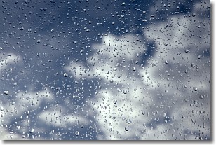
Weather Topic: What is Drizzle?
Home - Education - Precipitation - Drizzle
 Next Topic: Evaporation
Drizzle is precipitation in the form of water droplets which are
smaller than raindrops.
Drizzle is characterized by fine, gently falling droplets and typically does not
impact human habitation in a negative way. The exception to this is freezing drizzle,
a condition where drizzle freezes immediately upon reaching earth's surface.
Freezing drizzle is still less dangerous than freezing rain, but can
potentially result in hazardous road conditions.
Next Topic: Evaporation
Current conditions powered by WeatherAPI.com


