Weather Alert in Connecticut
Special Weather Statement issued February 6 at 11:33PM EST by NWS Upton NY
AREAS AFFECTED: Northern Fairfield; Northern New Haven; Northern Middlesex; Northern New London; Southern Fairfield; Southern New Haven; Southern Middlesex; Southern New London; Northwest Suffolk; Northeast Suffolk; Southwest Suffolk; Southeast Suffolk; Northern Nassau; Southern Nassau
DESCRIPTION: Snow has developed and is moving through portions of the region. It is light to locally moderate, and most steady across Southern Connecticut and much of Long Island. This will continue into the overnight. While mostly light, the snow will likely lead to some minor accumulations of mostly less than an inch over the next few hours. Visibilities will also be reduced to near 1 to 3 miles within the snow at times. Slippery conditions can be expected where any snow sticks to the surface. Motorists should proceed with extra caution and drive extra carefully, allowing for more spacing between vehicles.
INSTRUCTION: N/A
Want more detail? Get the Complete 7 Day and Night Detailed Forecast!
Current U.S. National Radar--Current
The Current National Weather Radar is shown below with a UTC Time (subtract 5 hours from UTC to get Eastern Time).

National Weather Forecast--Current
The Current National Weather Forecast and National Weather Map are shown below.

National Weather Forecast for Tomorrow
Tomorrow National Weather Forecast and Tomorrow National Weather Map are show below.

North America Water Vapor (Moisture)
This map shows recent moisture content over North America. Bright and colored areas show high moisture (ie, clouds); brown indicates very little moisture present; black indicates no moisture.

Weather Topic: What is Snow?
Home - Education - Precipitation - Snow
 Next Topic: Stratocumulus Clouds
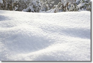
Snow is precipitation taking the form of ice crystals. Each ice crystal, or snowflake,
has unique characteristics, but all of them grow in a hexagonal structure.
Snowfall can last for sustained periods of time and result in significant buildup
of snow on the ground.
On the earth's surface, snow starts out light and powdery, but as it begins to melt
it tends to become more granular, producing small bits of ice which have the consistency of
sand. After several cycles of melting and freezing, snow can become very dense
and ice-like, commonly known as snow pack.
Next Topic: Stratocumulus Clouds
Weather Topic: What are Stratus Clouds?
Home - Education - Cloud Types - Stratus Clouds
 Next Topic: Wall Clouds
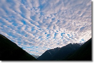
Stratus clouds are similar to altostratus clouds, but form at a
lower altitude and are identified by their fog-like appearance, lacking the
distinguishing features of most clouds.
Stratus clouds are wider than most clouds, and their base has a smooth, uniform
look which is lighter in color than a nimbostratus cloud.
The presence of a stratus cloud indicates the possibility of minor precipitation,
such as drizzle, but heavier precipitation does not typically arrive in the form
of a stratus cloud.
Next Topic: Wall Clouds
Current conditions powered by WeatherAPI.com


