Weather Alert in Ohio
Frost Advisory issued May 10 at 4:12AM EDT until May 10 at 8:00AM EDT by NWS Pittsburgh PA
AREAS AFFECTED: Tuscarawas; Carroll; Columbiana; Coshocton; Harrison; Jefferson; Muskingum; Guernsey; Belmont; Noble; Monroe; Mercer; Venango; Forest; Lawrence; Butler; Clarion; Jefferson; Beaver; Allegheny; Armstrong; Washington; Greene; Westmoreland; Westmoreland Ridges; Fayette; Fayette Ridges; Indiana; Higher Elevations of Indiana; Hancock; Brooke; Ohio; Marshall; Wetzel; Marion; Monongalia; Ridges of Eastern Monongalia and Northwestern Preston; Preston; Eastern Preston; Western Tucker; Eastern Tucker
DESCRIPTION: * WHAT...Temperatures as low as 30 will result in frost formation. * WHERE...Portions of east central Ohio, northwest, southwest, and western Pennsylvania, and northern and the northern panhandle of West Virginia. * WHEN...Until 8 AM EDT this morning. * IMPACTS...Frost could harm sensitive outdoor vegetation. Sensitive outdoor plants may be killed if left uncovered. * ADDITIONAL DETAILS...While many locations are in the middle 30s, a few of the colder spots so far include 33F at Cambridge Airport OH, 32F at Zelienople Airport in Beaver County PA, 31F just northwest of Waynesburg PA, and 30F at Moraine State Park in Butler County PA.
INSTRUCTION: Take steps now to protect tender plants from the cold.
Want more detail? Get the Complete 7 Day and Night Detailed Forecast!
Current U.S. National Radar--Current
The Current National Weather Radar is shown below with a UTC Time (subtract 5 hours from UTC to get Eastern Time).

National Weather Forecast--Current
The Current National Weather Forecast and National Weather Map are shown below.

National Weather Forecast for Tomorrow
Tomorrow National Weather Forecast and Tomorrow National Weather Map are show below.

North America Water Vapor (Moisture)
This map shows recent moisture content over North America. Bright and colored areas show high moisture (ie, clouds); brown indicates very little moisture present; black indicates no moisture.

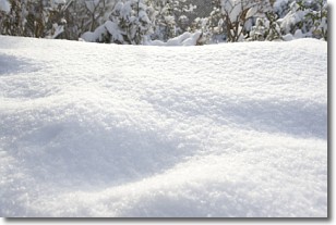
Weather Topic: What is Snow?
Home - Education - Precipitation - Snow
 Next Topic: Stratocumulus Clouds
Snow is precipitation taking the form of ice crystals. Each ice crystal, or snowflake,
has unique characteristics, but all of them grow in a hexagonal structure.
Snowfall can last for sustained periods of time and result in significant buildup
of snow on the ground.
On the earth's surface, snow starts out light and powdery, but as it begins to melt
it tends to become more granular, producing small bits of ice which have the consistency of
sand. After several cycles of melting and freezing, snow can become very dense
and ice-like, commonly known as snow pack.
Next Topic: Stratocumulus Clouds
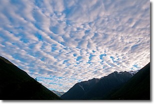
Weather Topic: What are Stratus Clouds?
Home - Education - Cloud Types - Stratus Clouds
 Next Topic: Wall Clouds
Stratus clouds are similar to altostratus clouds, but form at a
lower altitude and are identified by their fog-like appearance, lacking the
distinguishing features of most clouds.
Stratus clouds are wider than most clouds, and their base has a smooth, uniform
look which is lighter in color than a nimbostratus cloud.
The presence of a stratus cloud indicates the possibility of minor precipitation,
such as drizzle, but heavier precipitation does not typically arrive in the form
of a stratus cloud.
Next Topic: Wall Clouds
Current conditions powered by WeatherAPI.com


