Weather Alert in North Carolina
Flood Advisory issued July 9 at 8:28PM EDT until July 10 at 2:30AM EDT by NWS Blacksburg VA
AREAS AFFECTED: Watauga, NC; Wilkes, NC
DESCRIPTION: * WHAT...Flooding caused by excessive rainfall is expected. * WHERE...A portion of northwest North Carolina, including the following counties, Watauga and Wilkes. * WHEN...Until 230 AM EDT Thursday. * IMPACTS...Minor flooding in low-lying and poor drainage areas. River or stream flows are elevated. * ADDITIONAL DETAILS... - At 826 PM EDT, Doppler radar indicated heavy rain due to thunderstorms. Sudden river rises will cause minor flooding in the advisory area. Between 1 and locally close to 2 inches of rain have fallen since 7 pm. - This includes the following streams and drainages... North Prong Lewis Fork, Mill Creek, Elk Creek, South Fork New River, Little Dugger Creek, Left Prong Stony Fork, South Prong Lewis Fork, Fall Creek, South Fork Laurel Creek, Dugger Creek, Shell Creek, Beaver Creek and Flat Branch. Additional rainfall amounts up to 1 inch are expected over the area. This additional rain will result in minor flooding. - Some locations that will experience flooding include... Maple Springs... Elkville... Darby... Wilkesboro Reservoir... - For flooding safety information, please visit http://www.weather.gov/safety/flood
INSTRUCTION: Turn around, don't drown when encountering flooded roads. Most flood deaths occur in vehicles. When it is safe to do so, please send your reports of flooding, including mudslides or flooded roads, to the National Weather Service by calling toll free at 1...8 6 6...2 1 5...4 3 2 4. Reports and pictures can also be shared on the National Weather Service Blacksburg Facebook page and on X.
Want more detail? Get the Complete 7 Day and Night Detailed Forecast!
Current U.S. National Radar--Current
The Current National Weather Radar is shown below with a UTC Time (subtract 5 hours from UTC to get Eastern Time).

National Weather Forecast--Current
The Current National Weather Forecast and National Weather Map are shown below.

National Weather Forecast for Tomorrow
Tomorrow National Weather Forecast and Tomorrow National Weather Map are show below.

North America Water Vapor (Moisture)
This map shows recent moisture content over North America. Bright and colored areas show high moisture (ie, clouds); brown indicates very little moisture present; black indicates no moisture.

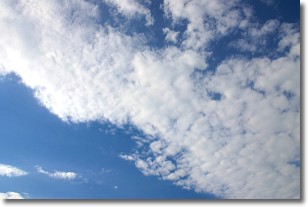
Weather Topic: What are Altocumulus Clouds?
Home - Education - Cloud Types - Altocumulus Clouds
 Next Topic: Altostratus Clouds
Similar to cirrocumulus clouds, altocumulus clouds are
characterized by cloud patches. They are distinguished by larger cloudlets
than cirrocumulus clouds but are still smaller than stratocumulus clouds.
Altocumulus clouds most commonly form in middle altitudes (between 2 and 5 km)
and may resemble, at times, the shape of a flying saucer.
These uncommon formations, called altocumulus lenticularis, are created by uplift
in the atmosphere and are most often seen in close proximity to mountains.
Next Topic: Altostratus Clouds
Weather Topic: What are Cirrocumulus Clouds?
Home - Education - Cloud Types - Cirrocumulus Clouds
 Next Topic: Cirrostratus Clouds
Cirrocumulus clouds form at high altitudes (usually around 5 km)
and have distinguishing characteristics displayed in a fine layer of
small cloud patches. These small cloud patches are sometimes referred to as
"cloudlets" in relation to the whole cloud formation.
Cirrocumulus clouds are formed from ice crystals and water droplets. Often, the
water droplets in the cloud freeze into ice crystals and the cloud becomes a
cirrostratus cloud. Because of this common occurrence, cirrocumulus cloud
formations generally pass rapidly.
Next Topic: Cirrostratus Clouds
Current conditions powered by WeatherAPI.com


