Weather Alert in New York
Special Weather Statement issued February 6 at 11:43PM EST by NWS Burlington VT
AREAS AFFECTED: Northern St. Lawrence; Northern Franklin; Southeastern St. Lawrence; Southern Franklin; Southwestern St. Lawrence
DESCRIPTION: At 1141 PM EST, snow showers with embedded snow squalls were reported along a line extending from 25 miles northwest of Louisville to 10 miles west of Waddington to near Kring Point State Park. Movement was east at 30 mph. HAZARD...Winds 25 mph or greater, and visibility less than a half mile. SOURCE...Radar indicated. IMPACT...Gusty winds may blow around unsecured objects. Low visibility will pose a hazard to motorists. Locations impacted include... Massena Village, Massena International Airport - Richards Field, Richville, Gouverneur Village, Canton Village, Rensselaer Falls, Norwood, Hammond Village, Potsdam Village, Heuvelton, Hermon Village, Morristown Village, De Peyster, Potsdam, Pierrepont, Massena, Bombay, Parishville, Moira, and Waddington.
INSTRUCTION: Conditions can deteriorate rapidly in winter weather situations. Be prepared for snow or ice covered roads. Slow down and allow extra time when traveling.
Want more detail? Get the Complete 7 Day and Night Detailed Forecast!
Current U.S. National Radar--Current
The Current National Weather Radar is shown below with a UTC Time (subtract 5 hours from UTC to get Eastern Time).

National Weather Forecast--Current
The Current National Weather Forecast and National Weather Map are shown below.

National Weather Forecast for Tomorrow
Tomorrow National Weather Forecast and Tomorrow National Weather Map are show below.

North America Water Vapor (Moisture)
This map shows recent moisture content over North America. Bright and colored areas show high moisture (ie, clouds); brown indicates very little moisture present; black indicates no moisture.

Weather Topic: What are Cirrocumulus Clouds?
Home - Education - Cloud Types - Cirrocumulus Clouds
 Next Topic: Cirrostratus Clouds
Cirrocumulus clouds form at high altitudes (usually around 5 km)
and have distinguishing characteristics displayed in a fine layer of
small cloud patches. These small cloud patches are sometimes referred to as
"cloudlets" in relation to the whole cloud formation.
Cirrocumulus clouds are formed from ice crystals and water droplets. Often, the
water droplets in the cloud freeze into ice crystals and the cloud becomes a
cirrostratus cloud. Because of this common occurrence, cirrocumulus cloud
formations generally pass rapidly.
Next Topic: Cirrostratus Clouds
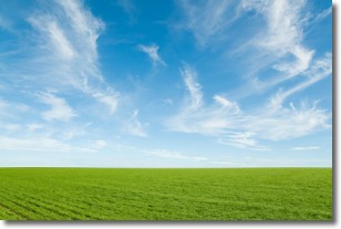
Weather Topic: What are Cirrus Clouds?
Home - Education - Cloud Types - Cirrus Clouds
 Next Topic: Condensation
Cirrus clouds are high-level clouds that occur above 20,000 feet
and are composed mainly of ice crystals.
They are thin and wispy in appearance.
What do they indicate?
They are often the first sign of an approaching storm.
Next Topic: Condensation
Current conditions powered by WeatherAPI.com


