Weather Alert in Alaska
Winter Weather Advisory issued February 26 at 3:26AM AKST until February 26 at 4:00PM AKST by NWS Juneau AK
AREAS AFFECTED: Ketchikan Gateway Borough
DESCRIPTION: ...PERIODS OF SNOW SHOWERS CONTINUE THROUGH THURSDAY... .Numerous snow showers are continuing to make their way across the gulf this early morning with a more organized band of showers in the NE Gulf near Cross Sound. Additional snowfall is expected through Thursday as these showers continue to stream in from the west, gradually tapering off from north to south through the day. Snowfall accumulations will be highly variable due to hit or miss nature of showers and locally higher amounts are expected. Temperatures will continue to gradually fall through Thursday across the northern panhandle. * WHAT...Snow. Additional snow accumulations of 1 to 3 inches. Total snow accumulations of 3 to 5 inches. * WHERE...Ketchikan Gateway Borough. * WHEN...Until 4 PM AKST Thursday. * IMPACTS...Travel could be difficult. The hazardous conditions could impact the morning or evening commute. * ADDITIONAL DETAILS...At 2 AM AKST, public report estimated 3 inches of snowfall on the northern side of Ketchikan. Intermittent snow showers will continue through Thursday afternoon. Given the nature of showers, snow accumulations will be highly variable with localized locations having a chance of seeing accumulations a few inches higher or lower then the above range.
INSTRUCTION: Slow down and use caution while traveling. People are urged to prepare their property before the onset of winter weather.
Want more detail? Get the Complete 7 Day and Night Detailed Forecast!
Current U.S. National Radar--Current
The Current National Weather Radar is shown below with a UTC Time (subtract 5 hours from UTC to get Eastern Time).

National Weather Forecast--Current
The Current National Weather Forecast and National Weather Map are shown below.

National Weather Forecast for Tomorrow
Tomorrow National Weather Forecast and Tomorrow National Weather Map are show below.

North America Water Vapor (Moisture)
This map shows recent moisture content over North America. Bright and colored areas show high moisture (ie, clouds); brown indicates very little moisture present; black indicates no moisture.

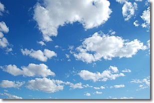
Weather Topic: What are Cumulonimbus Clouds?
Home - Education - Cloud Types - Cumulonimbus Clouds
 Next Topic: Cumulus Clouds
The final form taken by a growing cumulus cloud is the
cumulonimbus cloud, which is very tall and dense.
The tower of a cumulonimbus cloud can soar 23 km into the atmosphere, although
most commonly they stop growing at an altitude of 6 km.
Even small cumulonimbus clouds appear very large in comparison to other cloud types.
They can signal the approach of stormy weather, such as thunderstorms or blizzards.
Next Topic: Cumulus Clouds
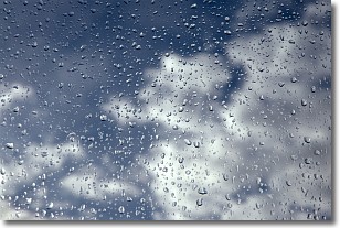
Weather Topic: What is Drizzle?
Home - Education - Precipitation - Drizzle
 Next Topic: Evaporation
Drizzle is precipitation in the form of water droplets which are
smaller than raindrops.
Drizzle is characterized by fine, gently falling droplets and typically does not
impact human habitation in a negative way. The exception to this is freezing drizzle,
a condition where drizzle freezes immediately upon reaching earth's surface.
Freezing drizzle is still less dangerous than freezing rain, but can
potentially result in hazardous road conditions.
Next Topic: Evaporation
Current conditions powered by WeatherAPI.com


