Weather Alert in Oregon
Beach Hazards Statement issued February 6 at 5:23AM PST until February 6 at 10:00PM PST by NWS Medford OR
AREAS AFFECTED: South Central Oregon Coast; Curry County Coast
DESCRIPTION: * WHAT...Moderate risk of sneaker waves. * WHERE...Beaches of Curry, Coos, and Douglas counties. * WHEN...Through this evening. * IMPACTS...Sneaker waves can run up significantly farther on beaches than normal, including over rocks and jetties. These waves can suddenly knock people off of their feet and sweep them into the ocean. The waves can also move logs or other objects which could crush or trap anyone caught underneath. * ADDITIONAL DETAILS...The highest risk will occur early this morning, and secondarily with the incoming high tide this afternoon. The next high tide will occur roughly around 2 to 3 PM PST. * View the hazard area in detail at https://www.wrh.noaa.gov/map/?wfo=mfr
INSTRUCTION: Avoid climbing on rocks and jetties. Stay away from the ocean and remain out of the water to avoid hazardous conditions.
Want more detail? Get the Complete 7 Day and Night Detailed Forecast!
Current U.S. National Radar--Current
The Current National Weather Radar is shown below with a UTC Time (subtract 5 hours from UTC to get Eastern Time).

National Weather Forecast--Current
The Current National Weather Forecast and National Weather Map are shown below.

National Weather Forecast for Tomorrow
Tomorrow National Weather Forecast and Tomorrow National Weather Map are show below.

North America Water Vapor (Moisture)
This map shows recent moisture content over North America. Bright and colored areas show high moisture (ie, clouds); brown indicates very little moisture present; black indicates no moisture.

Weather Topic: What are Cumulus Clouds?
Home - Education - Cloud Types - Cumulus Clouds
 Next Topic: Drizzle
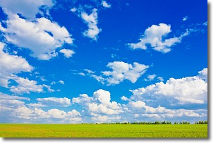
Cumulus clouds are fluffy and textured with rounded tops, and
may have flat bottoms. The border of a cumulus cloud
is clearly defined, and can have the appearance of cotton or cauliflower.
Cumulus clouds form at low altitudes (rarely above 2 km) but can grow very tall,
becoming cumulus congestus and possibly the even taller cumulonimbus clouds.
When cumulus clouds become taller, they have a greater chance of producing precipitation.
Next Topic: Drizzle
Weather Topic: What is Evaporation?
Home - Education - Precipitation - Evaporation
 Next Topic: Fog
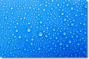
Evaporation is the process which returns water from the earth
back to the atmosphere, and is another crucial process in the water cycle.
Evaporation is the transformation of liquid into gas, and it happens because
molecules are excited by the application of energy and turn into vapor.
In order for water to evaporate it has to be on the surface of a body of water.
Next Topic: Fog
Current conditions powered by WeatherAPI.com


