Weather Alert in Hawaii
High Surf Warning issued February 6 at 3:36PM HST until February 7 at 6:00PM HST by NWS Honolulu HI
AREAS AFFECTED: Niihau; Kauai Southwest; Waianae Coast; Oahu North Shore; Kauai North; Molokai Windward; Molokai North; Molokai West
DESCRIPTION: ...HIGH SURF WARNING FOR NORTH AND WEST FACING SHORES OF NIIHAU KAUAI OAHU AND MOLOKAI AND FOR NORTH FACING SHORES OF MAUI THROUGH 6 PM HST SATURDAY... ...HIGH SURF ADVISORY FOR WEST FACING SHORES OF THE BIG ISLAND FROM 6 AM HST SATURDAY THROUGH 6 PM HST SATURDAY... .A large west-northwest to northwest swell (295-315 degrees) will build down the island chain through the evening and peak late tonight into early Saturday. The swell will decline sharply Saturday afternoon and evening, with surf expected to fall below headline levels by Sunday morning. * WHAT...Along north facing shores of Niihau, Kauai, Oahu, and Molokai, surf building to 20 to 30 feet tonight and continuing into early Saturday. Along west facing shores of Niihau, Kauai, Oahu, and Molokai, surf building to 15 to 22 feet tonight and continuing into Saturday. * WHERE...North and west facing shores of Niihau, Kauai, Oahu, and Molokai. * WHEN...Until 6 PM HST Saturday. * IMPACTS...High. Expect very strong breaking waves and powerful currents. Waves breaking in channel entrances may make navigating the channels dangerous.
INSTRUCTION: Stay away from the shoreline along the affected coasts. Be prepared for road closures. Postpone entering or leaving channels affected by the high surf until the surf subsides.
Want more detail? Get the Complete 7 Day and Night Detailed Forecast!
Current U.S. National Radar--Current
The Current National Weather Radar is shown below with a UTC Time (subtract 5 hours from UTC to get Eastern Time).

National Weather Forecast--Current
The Current National Weather Forecast and National Weather Map are shown below.

National Weather Forecast for Tomorrow
Tomorrow National Weather Forecast and Tomorrow National Weather Map are show below.

North America Water Vapor (Moisture)
This map shows recent moisture content over North America. Bright and colored areas show high moisture (ie, clouds); brown indicates very little moisture present; black indicates no moisture.

Weather Topic: What are Cirrocumulus Clouds?
Home - Education - Cloud Types - Cirrocumulus Clouds
 Next Topic: Cirrostratus Clouds
Cirrocumulus clouds form at high altitudes (usually around 5 km)
and have distinguishing characteristics displayed in a fine layer of
small cloud patches. These small cloud patches are sometimes referred to as
"cloudlets" in relation to the whole cloud formation.
Cirrocumulus clouds are formed from ice crystals and water droplets. Often, the
water droplets in the cloud freeze into ice crystals and the cloud becomes a
cirrostratus cloud. Because of this common occurrence, cirrocumulus cloud
formations generally pass rapidly.
Next Topic: Cirrostratus Clouds
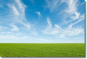
Weather Topic: What are Cirrus Clouds?
Home - Education - Cloud Types - Cirrus Clouds
 Next Topic: Condensation
Cirrus clouds are high-level clouds that occur above 20,000 feet
and are composed mainly of ice crystals.
They are thin and wispy in appearance.
What do they indicate?
They are often the first sign of an approaching storm.
Next Topic: Condensation
Current conditions powered by WeatherAPI.com


